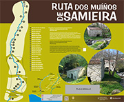
The Spiritual Variant of Camino de Santiago

Start:

Fragamoreira (San Xoán de Poio)

Distance:

Approximately 10 kilometres (through the municipality of Poio).

Difficulty:

Low.

The so-called “Spiritual Variant” of the road to Santiago passes through Poio. This itinerary joins two Jacobean routes: the “Portuguese Way” and the “Way of the Sea”, crossing the regions of Salnés and Arousa. It is divided into three sections that total 73 kilometres altogether, beginning in the Praza da Peregrina in the city of Pontevedra. The last section is also known as La Traslatio because it follows the journey by sea to Padrón of the remains of St James the Apostle.

The path of the Camino through Poio begins at Fragamoreira (San Xoán de Poio). The first few kilometres of the path coincide with the Padre Sarmiento Route. The first important stop is the San Xoán de Poio Monastery, and from here it continues onto the A Reiboa – A Seca cove, where you can visit the Memory Park. The route continues along the coast to the historical site of Combarro, where it separates from the Padre Sarmiento Route and heads north towards the monastery of Armenteira in the municipality of Meis.

This route was awarded with the distinction of “Blue Path 2023” granted by the Association of Environmetal Education and Consumer ADEAC.

Blue Trail 2023

This route belongs to the network of Blue Trails created by the Association of Environmetal Education and Consumer ADEAC.

Padre Sarmiento Route

Start:

Monasterio de San Xoán de Poio (San Xoán de Poio).

Distance:

Approximately 12 kilometres (through the municipality of Poio).

Difficulty:

Low.

This route follows the route taken in 1745 by the enlightened monk Friar Martín Sarmiento on his pilgrimage to Compostela, which he documented in his work “Viaje a Galicia” (Journey to Galicia). The entire route of 190 kilometres passes through the municipalities of Pontevedra, Poio, Sanxenxo, O Grove, Meaño, Cambados, Vilanova de Arousa, A Illa de Arousa and Vilagarcía, Catoira and Pontecesures.

Approximately 12 kilometres of the first stage of the itinerary crosses through the municipality of Poio (Pontevedra – Sanxenxo). From Pontevedra, you reach it through Fragamoreira, and the first major point of interest is the Monastery of San Xoán de Poio. From here, the path continues towards the coast to the Reiboa – A Seca cove, passing through the Memory Park. After this point, the route follows the coast entirely and leads to the historical site of Combarro and then continues westwards along the beaches of Chancelas, Ouriceira, Area da Barca, Covelo, Laño and Raxó. After Raxó (San Gregorio de Raxó) the route continues through the municipality of Sanxenxo.

The Samieira Watermills Route

Start:

Praza de Alfredo Romay Besada (San Xoán de Poio).

Distance:

5,5 Kilómetros (ida y vuelta).

Difficulty:

Low.

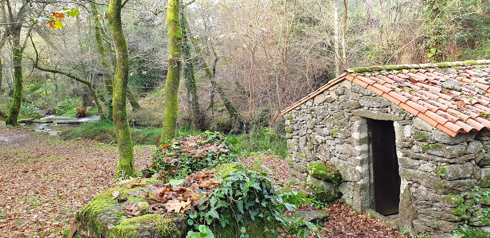
This itinerary passes a total of 23 mills along the course of the river Freiría, also called Rego dos Muíños or Rego dos Frades. According to tradition, the name derives from the fact that at the source of the river in O Busto, a nobleman who became a friar built a monastery, but of which no traces survive.

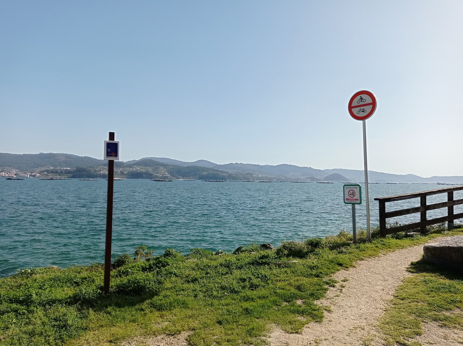
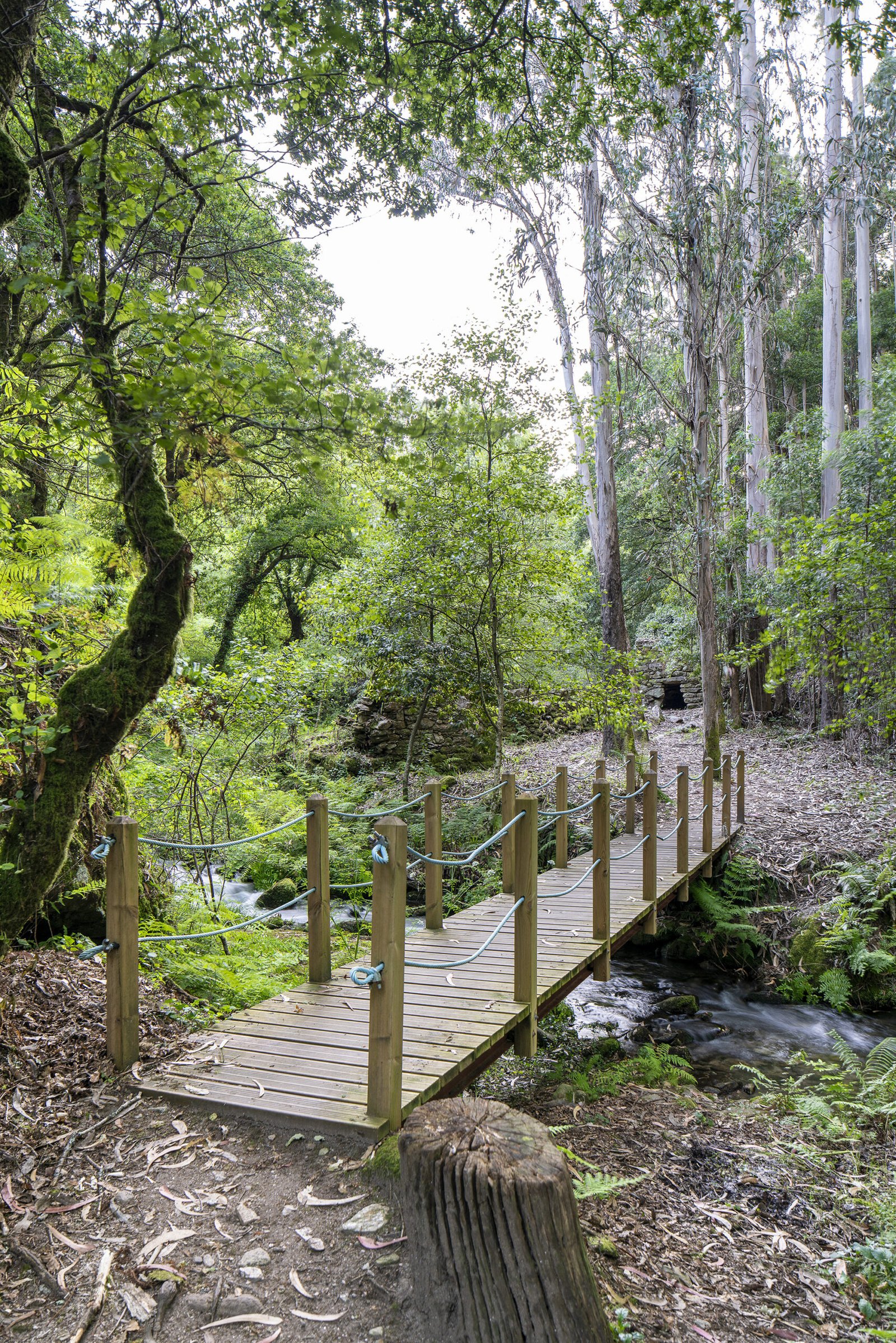
The walk begins in Praza de Alfredo Romay, at the so-called Muiño de Cubo de Abaixo and proceeds upstream, keeping close to the riverbank, passing through riverside woodlands with ash, birch, hazel, willow and oak trees. The entire route has been provided with a dirt path for walking along with multiple wooden footbridges to bypass gradients and to ford the stream.  Rest areas have also been provided, with tables and benches
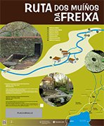
Download Panel

The A Freixa Route

Start:

Área Deportiva de A Seca (San Xoán de Poio).

Distance:

1.8 kilometres (return journey).

Difficulty:

Baja.

The itinerary begins and ends at the mouth of the Cancela brook, beside the A Seca sports area and the Parque da Memoria (Memory Park), designed by Nobel Prize winner Adolfo Pérez Esquivel. The route proceeds upstream and, along a stretch of less than one kilometre, passes nine mills, seven of which have been restored. The Muiño de Arriba mill has been entirely reconstructed, including all of the essential machinery for its operation. In addition to the watermills, also worth mentioning are the “pontellas”, small bridges for crossing the river, the cobbled sections of the road, and the channels that carried water to the “rodicios” (waterwheels), such as the 40-metre-long channel of Muíño da Bufa.

The path passes through an area of rich ecological importance, among alders, willows, birches and oaks. This is an excellent opportunity to look out for the many species of wildlife, including birds such as wagtails, reptiles such as the Iberian emerald lizard and amphibians such as salamanders and Iberian frogs.

Download Panel

Pereiro Waterfalls

Start:

Pereiro de Abaixo (San Xoán de Poio). 

Distance:

1.5 kilometres (return journey).

Difficulty:

Low.

This route runs along the banks of the Pereiro stream, a watercourse originating from several springs that converge at the Cachada da Randa and flows into the A Reiboa – A Seca cove, next to the Parque da Memoria (Memory Park).

The trail begins at A Ponte Vella, in the higher part of the area, and rises through a typical riverbank woodland, passing over multiple wooden bridges and by three abandoned mills. Among the route’s greatest attractions are its waterfalls. The first, called A Pindilleira, is located 475 metres from the start and is almost 7 metres high. The Freixa Alta waterfall is to be found just at the end of the path and is 10 metres high. Although the route is not challenging, it does have steeper sections than other routes in Poio.

Ostreira Path

Start:

Muelle de Campelo (San Xoán de Poio).

Distance:

1.8 kilometres (return journey).

Difficulty:

Low.

This route’s name derives from the fact that it passes along a stretch of shoreline that was formerly one of the estuary’s most important oyster-producing areas. In fact, the first oyster farm of the Iberian Peninsula was set up here in 1868. However, over time, overexploitation of the resource led to the disappearance of the activity, although it has left its legacy in its name.

This is a 1.8-kilometre-long route, there and back, and is of low difficulty. You can begin the route at the Campelo dock in San Xoán de Poio. The path follows the coast up to the A Seca Recreational Area and has beautiful views of the Pontevedra estuary, the island of Tambo and Illote dos Ratos. From there, you can continue the walk along the A Freixa Mills Route.

Do Laño Path

Start:

Muelle de Campelo (Covelo-Samieira).

Distance:

1,2 kilometres

Difficulty:

Low.

This path runs along part of the Samieira coastline, passing through small coves and oak woodlands. This is a relatively easy route and is 1.2 kilometres long. The path begins at the Covelo Dock and follows the coastline of the parish of Santa María de Samieira, passing through the beaches of Covelo, O Caeiro and Laño. At the end of the route, you can take in the splendid views of the Pontevedra estuary from the Laño viewpoint. One of the most beautiful walking trails in the area, the Samieira Watermills Route, is close by.